
Filter by
SubjectRequired
LanguageRequired
The language used throughout the course, in both instruction and assessments.
Learning ProductRequired
LevelRequired
DurationRequired
SkillsRequired
SubtitlesRequired
EducatorRequired
Results for "gis software"
 Status: NewStatus: Free Trial
Case Western Reserve University
Skills you'll gain: Exploratory Data Analysis, Spatial Data Analysis, Spatial Analysis, Geospatial Information and Technology, Descriptive Statistics, Statistical Modeling, R Programming, Geographic Information Systems, Statistical Analysis, R (Software), Probability & Statistics, Ggplot2, Oil and Gas, Data Analysis, Simulations, Statistical Methods, Rmarkdown, Data Cleansing, Box Plots, Plot (Graphics)
 Status: Preview
University of Michigan
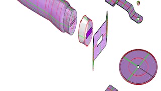
Skills you'll gain: 3D Modeling, 3D Assets, Visualization (Computer Graphics), Computer-Aided Design, Design, Graphic and Visual Design, Architectural Design, Creativity
 Status: Free Trial
L&T EduTech
Skills you'll gain: Construction Engineering, Geospatial Mapping, Geospatial Information and Technology, Geographic Information Systems, Spatial Data Analysis, Construction, Construction Management, Visualization (Computer Graphics), Spatial Analysis, Global Positioning Systems, GIS Software, As-Built Drawings, Survey Creation, AutoCAD Civil 3D, 3D Modeling, Data Import/Export
 Status: NewStatus: Free Trial
Skills you'll gain: GitHub, Version Control, Git (Version Control System), Unix Commands, Unix Shell, Software Versioning, Linux Commands, Command-Line Interface, Software Configuration Management, File Management
 Status: Free Trial
University of California, Davis
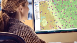
Skills you'll gain: ArcGIS, Data Storytelling, Spatial Data Analysis, Data Presentation, Geographic Information Systems, Spatial Analysis, Geospatial Mapping, Heat Maps, Data Visualization Software, Network Analysis, Data Manipulation
 Status: Free Trial
University of Toronto
Skills you'll gain: Geographic Information Systems, GIS Software, Spatial Analysis, Spatial Data Analysis, Geospatial Information and Technology, Geospatial Mapping, Query Languages, Data Manipulation, Image Analysis
 Status: Preview
Yonsei University
Skills you'll gain: Spatial Data Analysis, Spatial Analysis, Geographic Information Systems, Geospatial Mapping, Database Management Systems, Big Data, Apache Hadoop, PostgreSQL, Network Analysis
 Status: Free Trial
University of Illinois Urbana-Champaign
Skills you'll gain: 3D Modeling, Design Software, 3D Assets, Conceptual Design, Visualization (Computer Graphics), Computer Graphics, Graphical Tools, Technical Communication
 Status: Preview
École Polytechnique Fédérale de Lausanne
Skills you'll gain: Geographic Information Systems, Data Modeling, GIS Software, SQL, Database Design, Spatial Data Analysis, Database Management, Query Languages, Relational Databases, Data Capture, Data Storage
 Status: Preview
EDUCBA
Skills you'll gain: Embedded Software, Real-Time Operating Systems, Software Development, Software Design, Software Architecture, Embedded Systems, Configuration Management, Systems Architecture, Application Development, System Configuration, Application Frameworks
 Status: Preview
University of Michigan
Skills you'll gain: Data Structures, 3D Modeling, Computational Logic, Visualization (Computer Graphics), Design, Generative Model Architectures, Python Programming, Animations, Scripting, Computer Programming
 Status: Preview
École Polytechnique Fédérale de Lausanne
Skills you'll gain: Spatial Analysis, Spatial Data Analysis, GIS Software, Geographic Information Systems, Geospatial Mapping, Geostatistics, Interactive Data Visualization, Data Integration, Data Mapping, Augmented Reality, Sampling (Statistics)
Searches related to gis software
In summary, here are 10 of our most popular gis software courses
- Practical Geospatial Geostatistical Modeling: Case Western Reserve University
- Introduction to 3D Modeling: University of Michigan
- Geospatial Technology for Construction : L&T EduTech
- Introduction to Git and GitHub Basics: Packt
- Geospatial Analysis with ArcGIS : University of California, Davis
- Spatial Analysis and Satellite Imagery in a GIS: University of Toronto
- Spatial Data Science and Applications: Yonsei University
- 3D Printing Software: University of Illinois Urbana-Champaign
- Systèmes d’Information Géographique - Partie 1: École Polytechnique Fédérale de Lausanne
- Introduction to AutoSAR: EDUCBA


